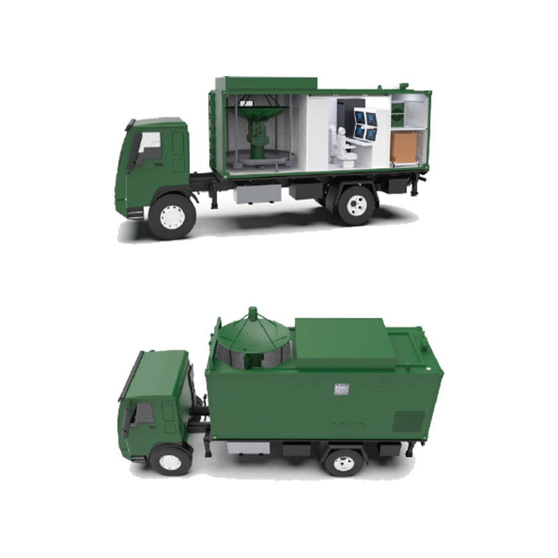
How to improve the automatic leveling accuracy and ensure tracking stability when deploying a medium-caliber vehicle-mounted satellite ground platform in complex terrain?
Publish Time: 2026-05-29
In applications such as satellite communication, remote sensing and control, emergency communication, and flight target tracking, the medium-caliber vehicle-mounted satellite ground platform plays a crucial role due to its high mobility, rapid deployment, and environmental adaptability. Especially in complex field environments such as mountains, deserts, grasslands, and disaster relief sites, the platform often needs to be rapidly deployed and operational under non-ideal ground conditions. However, factors such as changes in ground slope, differences in soil bearing capacity, and unstable vehicle parking posture can easily affect antenna leveling accuracy and subsequent tracking performance.1. Improving the Accuracy of the Automatic Leveling System to Solidify the Operational FoundationThe automatic leveling system is fundamental to the normal operation of the vehicle-mounted satellite ground platform. If the platform's levelness is insufficient after antenna deployment, it will directly affect antenna pointing accuracy and tracking performance. Therefore, high-precision tilt sensors and attitude measurement units are needed to detect the vehicle's current attitude in real time. Through coordinated control of multi-point hydraulic support devices, the vehicle body can complete automatic leveling in a short time. Simultaneously, combining high-resolution measurement technology enables more precise level correction, ensuring the platform reaches a stable operating state and providing a reliable foundation for subsequent satellite tracking.2. Optimizing the Hydraulic Support Structure to Enhance Terrain AdaptabilityGround conditions vary greatly in complex field environments, with some areas potentially containing soft soil, gravel roads, or irregular slopes. Insufficient adaptability of the support system can easily lead to settlement or attitude changes. Therefore, it is necessary to optimize the hydraulic outrigger structure design to increase the support area and load-bearing capacity. For areas with steep slopes, independently controlled hydraulic outriggers can be used, allowing each support point to automatically adjust its height according to the actual terrain, thereby maintaining the overall level of the platform. Furthermore, the anti-slip and anti-sinking structure design at the bottom of the support feet also effectively improves stability in complex terrain.3. Introducing Multi-Sensor Fusion Technology to Improve Leveling AccuracySingle sensors are easily affected by vibration, temperature changes, or geomagnetic interference in complex environments. Therefore, modern vehicle-mounted platforms typically employ multi-sensor fusion technology. By comprehensively analyzing data from inertial navigation systems, tilt sensors, satellite positioning systems, and electronic compasses, real-time attitude information of the platform can be obtained more accurately. When a sensor malfunctions, the system can automatically correct it through data cross-validation, thereby improving leveling accuracy and system reliability, and preventing measurement errors from affecting satellite tracking performance.4. Enhancing Servo Control Capabilities to Ensure Tracking StabilityAfter leveling, the antenna servo system needs to continuously and accurately track low-orbit satellites or flying targets. In complex field environments, wind disturbances, slight vehicle swaying, and ground vibrations can all affect tracking accuracy. Therefore, a high-response servo drive system is required, combined with a high-precision encoder for real-time position feedback. A closed-loop control algorithm continuously corrects antenna pointing deviations, enabling the system to quickly respond to external disturbances, maintain stable tracking, and improve target acquisition and signal reception capabilities.5. Applying Intelligent Compensation Algorithms to Reduce Environmental InterferenceDuring actual mission execution, relying solely on mechanical structures and hardware control is insufficient to completely eliminate environmental influences. Therefore, intelligent compensation algorithms can be introduced to analyze and predict factors such as wind load, support settlement, and vehicle micro-vibrations in real time. The system establishes a dynamic compensation model to adjust antenna attitude parameters in advance, thereby reducing the impact of external interference on tracking accuracy. Furthermore, self-learning optimization based on historical operational data can further improve long-term stability in complex environments.6. Strengthening System Cooperative Control to Enhance Overall ReliabilityThe automatic leveling system, hydraulic system, power supply system, and antenna servo system do not operate independently but are interconnected as a whole. By establishing a unified control platform to achieve data sharing and cooperative control among the subsystems, overall operational efficiency can be effectively improved. For example, the antenna deployment program is automatically triggered after leveling is completed, and the compensation mechanism is automatically activated when attitude changes are detected, thus forming a complete intelligent control closed loop to ensure the platform always maintains optimal operating conditions.In summary, during the deployment of the medium caliber vehicle mounted satellite ground platform in complex field terrain, improving the accuracy of the automatic leveling system, optimizing the hydraulic support structure, introducing multi-sensor fusion technology, enhancing servo control capabilities, applying intelligent compensation algorithms, and strengthening system cooperative control can effectively improve automatic leveling accuracy and ensure tracking stability. This not only improves the success rate of satellite communication and target tracking missions but also provides more reliable technical support for the development of modern mobile telemetry and control systems.